6.1 Concept of Scale
Module 6.1
Concept of Scale
Scientists who study the atmosphere must be aware of both the spatial and time scale of the weather phenomena being examined. The larger the area affected by a weather system, the longer time this system takes to move or change. An example would be the persistent global circulation patterns observed around the Earth. Smaller systems have the opposite characteristics. An example would be a thunderstorm, which can be “born”, wreak havoc and decay within several hours, but only affect a neighborhood within a city.
The largest scale is called the global scale. Global scale features affect the entire Earth or a hemisphere and are persistent year after year. Any changes occurring on a global scale are usually related to the seasons. Persistent global scale weather features are the trade winds in the tropics and subtropics from the equator to about 30o latitude. Trade winds are the easterly surface winds that exist in both the Northern and Southern Hemisphere. Commerce relied on the trade winds for hundreds of years prior to the invention of the steam and internal combustion engines. Even today the trade winds are a factor when navigating the tropics.
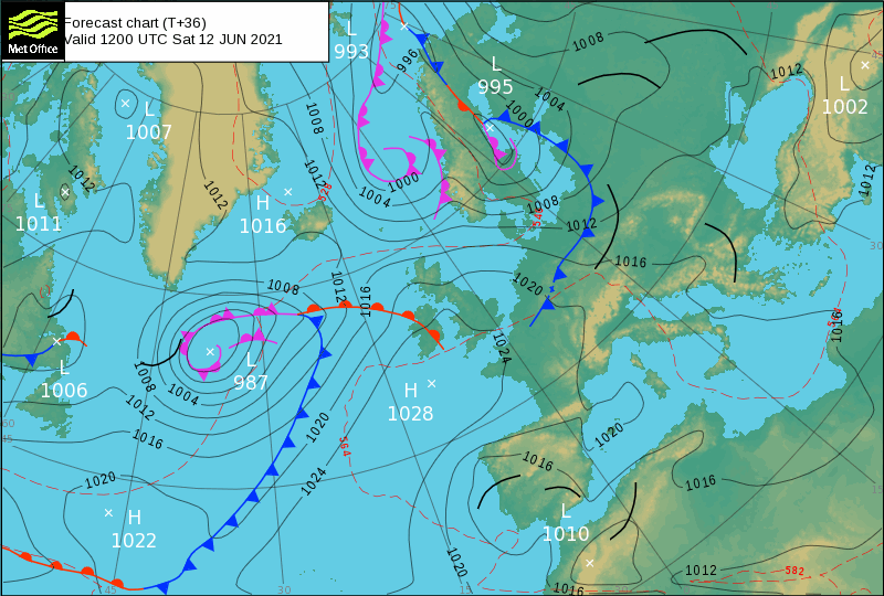
The next size scale is synoptic scale. Synoptic scale covers a portion of a continent and persists from several days to several months. The cyclones and troughs associated with a winter storm are a classic synoptic scale weather feature. When examining a surface weather map, the annotation of fronts are synoptic scale features. Fronts are the blue and red lines with half circles or triangles attached on this image depicting the Northern Atlantic Ocean and Europe.
The smaller scale is called the mesoscale. Mesoscale phenomena cover from a few to several hundred kilometers and may last up to a day. Other terms which may be used when examining these smaller scales are microscale (2km or less) and misoscale (4 km or less). As mentioned previously a thunderstorm is a mesoscale phenomenon. Strong winds exiting a thunderstorm are called a microburst, which is based on these smaller scales nomenclature. This photo shows microburst damage.
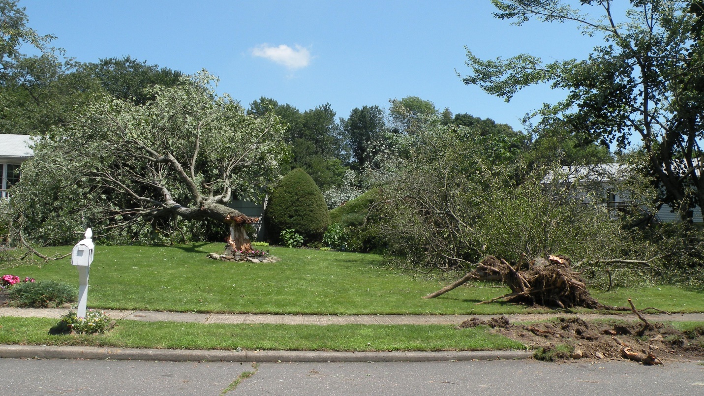
Notice how the surrounding trees and mailbox were untouched by these strong winds. The winds were very localized with a speed estimate of over 100 mph.
Weather phenomena associated with the global and synoptic scales are examined in this module. Smaller scale phenomena will be covered in future modules. All of these weather features are described using a conceptual model. A conceptual model takes known facts about a system and fits them together into a simplified representation of what is occurring. Conceptual models are used widely in science and other fields. Since conceptual models are a simplification of a system, they are not 100% accurate. However conceptual models take the best science available and enable a broad range of people to understand what is happening.
Everything examined in this course essentially uses a conceptual model. For example, the air parcel concept used previously to examine atmospheric stability is a conceptual model.
